Geospatial binning with hexagons on spark
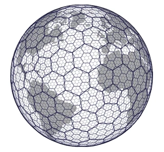
Discrete global grid systems recently got quite some attention in the GIS community when Uber released H3 https://eng.uber.com/h3/.
It is a hexagonal spatial index. Neighbours can be accessed easily.
Several tasks are supported:
- spatial index
- spatial smoothing
- efficient spatial join
And a variety of libraries around the core c based code has been created. https://github.com/uber/h3-py-notebooks nicely demonstrates how spatial anomaly detection can be quickly built using the python API.
But wouldn’t it also be great to use this functionality in spark? They do provide a java library: https://github.com/uber/h3-java
Adding this to spark is straight forward. Using your build tool of choice first add a dependency to the jar.
// https://mvnrepository.com/artifact/com.uber/h3
compile group: 'com.uber', name: 'h3', version: '3.6.0'
or just start an interactive shell such as:
spark-shell --packages 'com.uber:h3:3.6.0'
and run:
import com.uber.h3core.H3Core
import org.apache.spark.sql.expressions.UserDefinedFunction
import org.apache.spark.sql.DataFrame

@transient lazy val h3 = new ThreadLocal[H3Core] {
    override def initialValue() = H3Core.newInstance()
  }


def convertToH3Address(xLong: Double, yLat: Double, precision: Int): String = {
    h3.get.geoToH3Address(yLat, xLong, precision)
  }

val geoToH3Address: UserDefinedFunction = udf(convertToH3Address _)

def createSpatialIndexAddress(result: String,
                                XLongColumn: String,
                                YLatColumn: String,
                                precision: Int)(df: DataFrame): DataFrame = {
    df.withColumn(
      result,
      geoToH3Address(col(XLongColumn), col(YLatColumn), lit(precision)))
  }
which can now be used as:
val df = Seq((1,2), (3,4)).toDF("x", "y")
df.transform(createSpatialIndexAddress("h3","x", "y", 7)).show(false)

+---+---+---------------+
|x  |y  |h3             |
+---+---+---------------+
|1  |2  |877545796ffffff|
|3  |4  |8775642cdffffff|
+---+---+---------------+
Other functions of the H3 library can be supported similarly. Using the hexagons greatly simplifies efficient spatial smoothing and aggregation (hexbinning).
This was a repost. The original post is found here: https://georgheiler.com/2019/11/20/geospatial-binning-with-hexagons-on-spark/